الأقمار الصناعية تكشف عن تحرك أكبر الجبال الجليدية فى العالم

كثيرا ما تنشأ الجبال الجليدية نتيجة للأنهار الجليدية، والتى يمكن أن تتحرك من مكانها لعدة عوامل، ولعل من بين ذلك واحد من

كثيرا ما تنشأ الجبال الجليدية نتيجة للأنهار الجليدية، والتى يمكن أن تتحرك من مكانها لعدة عوامل، ولعل من بين ذلك واحد من أكبر الجبال الجليدية فى العالم، والذى يسمى A-68، والذى رصدت صور الأقمار الصناعية رحلته الحالية من القارة القطبية الجنوبية التي وصلت لأكثر من 155 ميلاً (250 كم) نحو جورجيا الجنوبية.

ووفقا لما ذكره موقع صحيفة “ديلى ميل” البريطانية، فإنه نظرًا لكون الجبل الجليدي قد انطلق من الجرف الجليدي في القارة القطبية الجنوبية (Larson C) قبل عامين، فإن الجبل الجليدي قد قام بالدوران بزاوية 270 درجة وانجرف على مسافة 155 ميلًا شمالًا، يحمله تيار المحيط.

وتبلغ مساحته 2239 ميلاً مربعًا، فهو يساوى أضعاف مساحة لندن، وحجمه ضعف بحيرة إيري، حيث تتم عملية إنشاء جليد من الجليد بشكل طبيعى، فتزود الأنهار الجليدية الداخلية الرفوف الجليدية الساحلية بجليد جديد، ويتم دفع الجليد الأقدم إلى البحر.

وتشير مجموعة من الأدلة إلى أن ارتفاع درجات حرارة الماء والهواء الناجم عن الاحتباس الحراري يؤدي إلى زعزعة الاستقرار على طول سواحل أنتاركتيكا وجرينلاند، مما يسرع من الذوبان
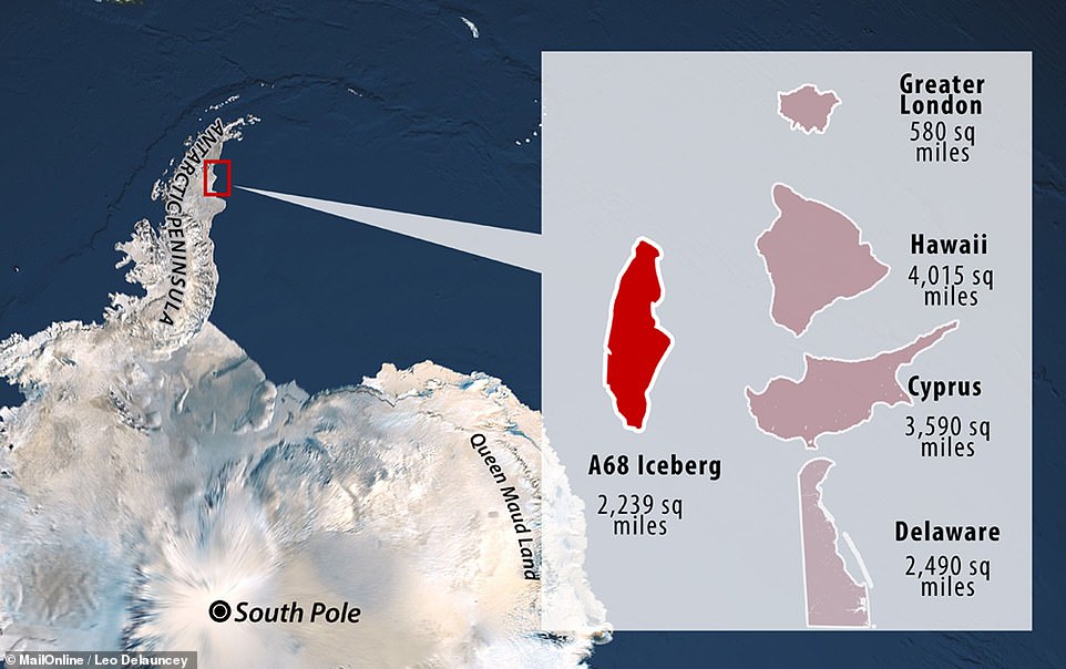
One of the largest icebergs in the world, A-68, is on the move and new footage compiled from satellite images tracks its more than 155 mile (250km) journey towards South Georgia. At 2,239 sq miles it is roughly the size of Delaware (2,490 sq miles), or four times the size of Greater London 580 sq miles, and its volume is twice that of Lake Erie

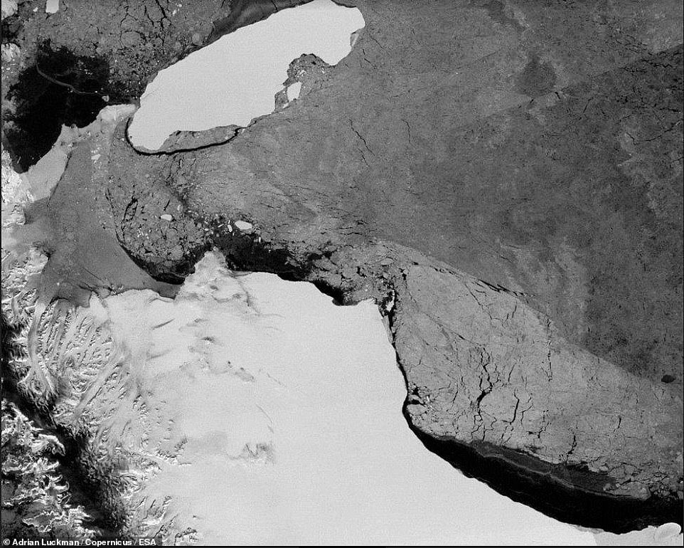
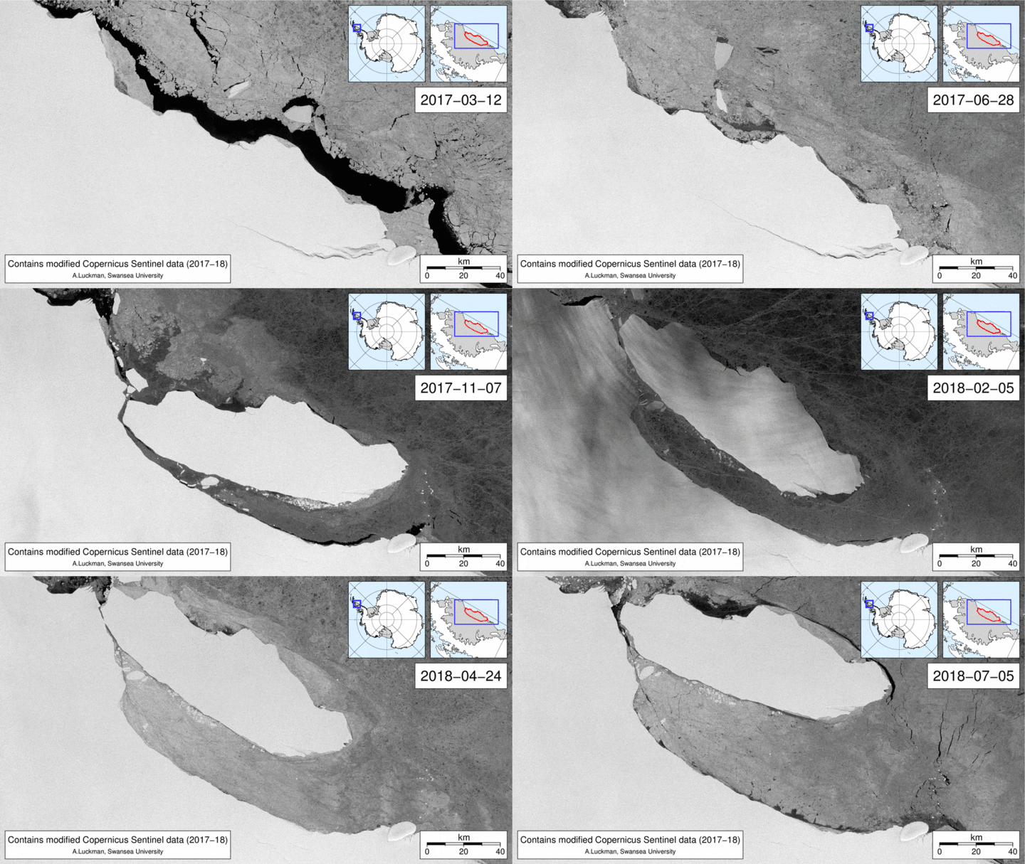
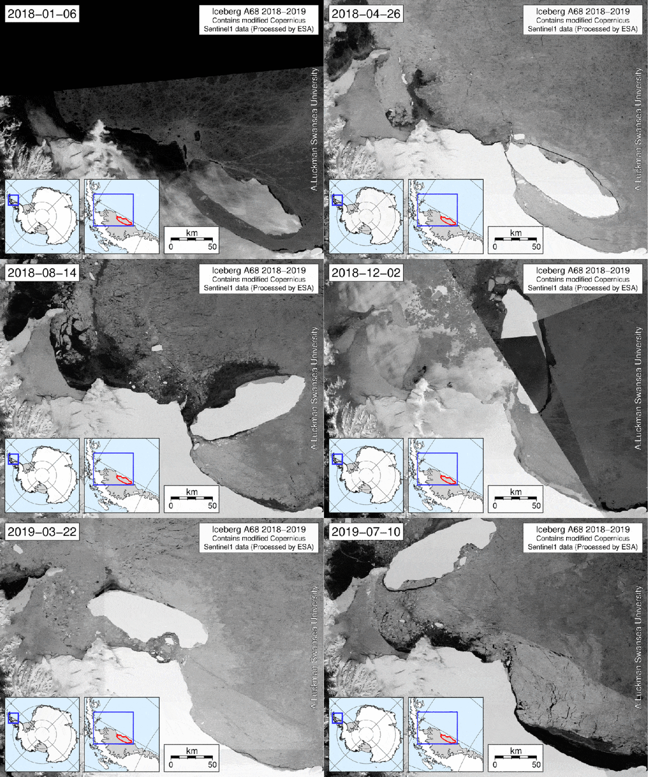
Since it calved from Antarctica's Larson C ice shelf two years ago, the iceberg has rotated 270 degrees and drifted 155 miles north, carried by the ocean current known as the Weddell Gyre. Pictured: A-68 in it begins to break away from it's starting position

At 2,239 sq miles (5,800 sq km) it is roughly the size of Delaware (2,490 sq m / 6,450 sq km), or four times the size of Greater London 580 sq m (1,500 sq m), and its volume is twice that of Lake Erie. Pictured: A-68 where it currently resides Iceberg calving is a natural phenomenon - as inland glaciers supply coastal ice shelves with new ice, older ice is pushed out to sea

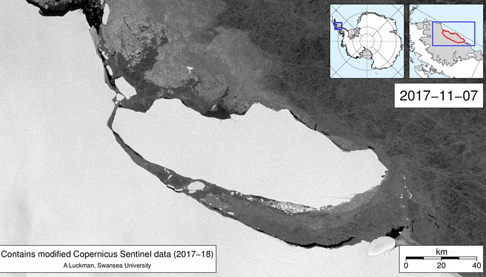
A growing body of evidence suggests rising water and air temperatures caused by global warming are triggering instabilities along the coasts of Antarctica and Greenland, accelerating melting and increases the rates of calving Pictured: A-68's position back in November 2017

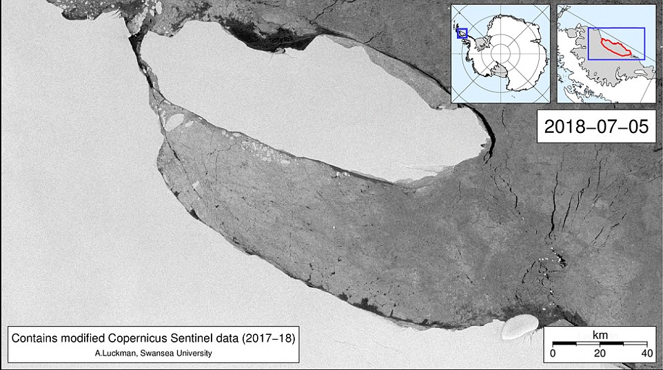
Glacier expert Adrian Luckman, a geography professor at Swansea University in Wales, published an animation of the glacier's movements between January 6, 2018 and July 10, 2019 on his blog. Pictured: A-68's position in July, 2018

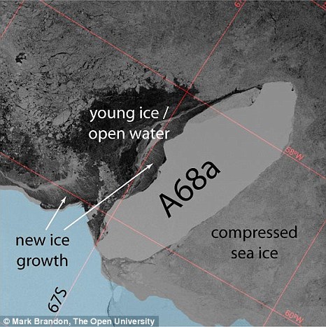
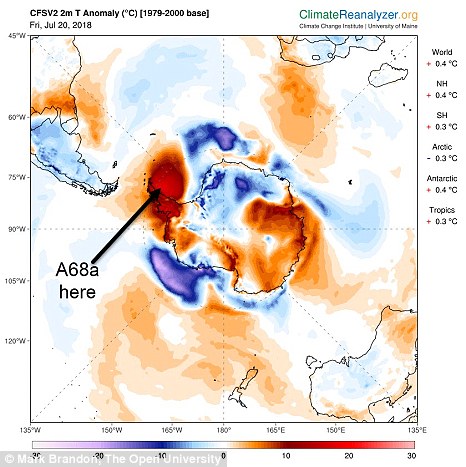
Sentinel-1 SAR satellite imagery from 29 August 2018 shows that to the north of the iceberg the wind is pushing the sea ice northwards faster than the iceberg is rotatingA 'temperature anomaly' on 20 July 2018, when it was almost 20 °C warmer than the mean over the Weddell Sea and Larsen Ice shelf.

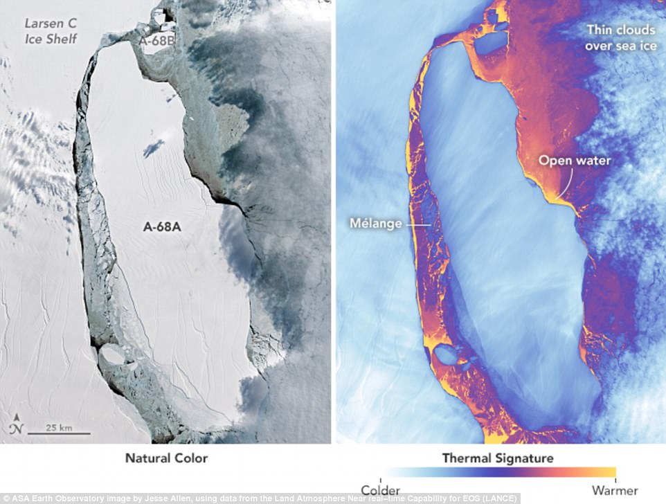
Stunning new satellite images have revealed the movement of the massive iceberg that calved from the Larsen C ice shelf in July. The detailed images captured by instruments aboard NASA’s Landsat 8 show the widening gap between the main shelf and the ice berg, with a thin layer of loose, floating ice in between


Source: Tamol.om

اترك ردّاً

لن يتم نشر عنوان بريدك الإلكتروني. الحقول الإلزامية مشار إليها بـ *