بالفيديو والصور.. ناسا تنشر صورًا مذهلة لسطح المريخ لم تشاهدها من قبل

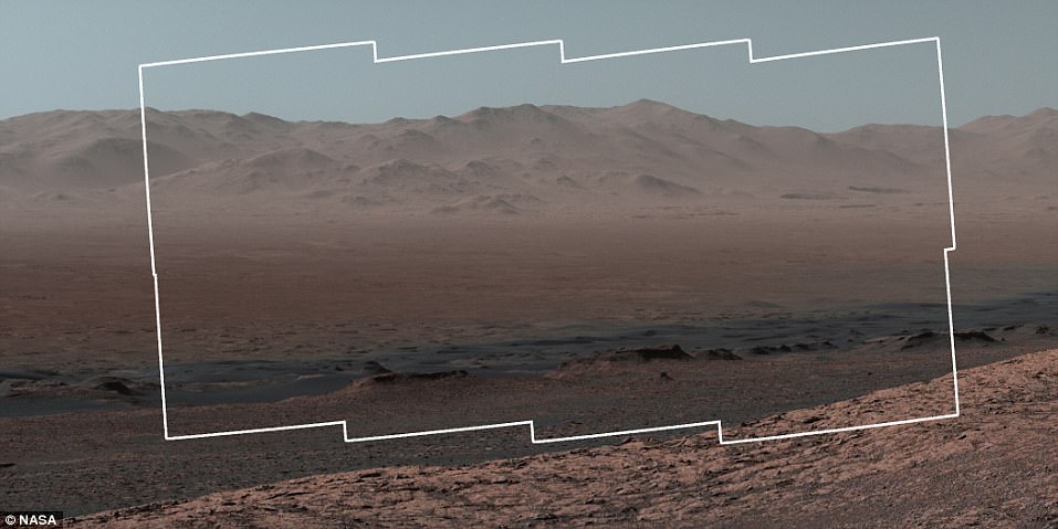
نشرت وكالة الفضاء والطيران الأميركية، الجمعة، صورة بانورامية تظهر بعضا من تضاريس كوكب المريخ.وذكرت الوكالة أن الفيديو عبارة عن 16

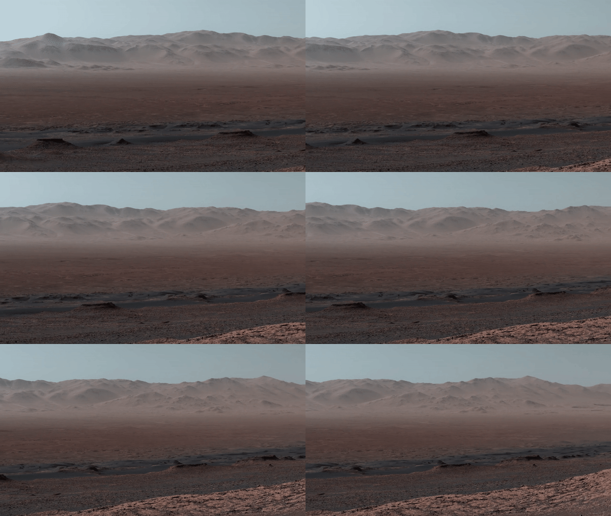
نشرت وكالة الفضاء والطيران الأميركية، الجمعة، صورة بانورامية تظهر بعضا من تضاريس كوكب المريخ.وذكرت الوكالة أن الفيديو عبارة عن 16 صورة فوتوغرافية جرى دمجها مع بعضها البعض.

والتقطت الصور المركبة “كيوريوسيتي روفر” التي أرسلت عام 2012 في مهمة إلى الكوكب الأحمر بعد رحلة استمرت 8 أشهر.

وذكرت الوكالة أن المركبة التقطت 16 صورة للتضاريس من زوايا مختلفة في إحدى رحلاتها، وأظهرت الصور تشابها بين تضاريخ الكوكب الأحمر وتضاريس الأرض.

وذكرت “ناسا” أن هذه المهمة تمت في الـ 25 من أكتوبر 2017، أي بعد مرور أكثر من 1800 يوم على وجود المركبة في المريخ.

وأشارت إلى الصور التقطت في منطقة فوهة غيل الناجمة عند اصطدام جرم سماوي بالكوكب الأحمر.
This aerial shot shows the area that the Mars Curiosity rover is in and where it has travelled so far on its journey. The 'hill outside gale crater' at the top of the shot is visible in the panoramic image and is over 50 miles (80 km) away from the rover

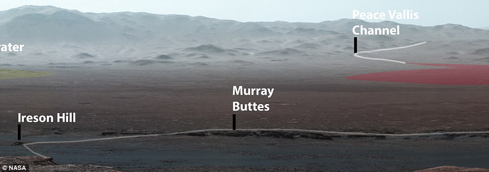
Nasa also released an annotated version of the panoramic photo that shows notable places from the mission, such as 'Murray Buttes' and the Peace Vallis Channel. The entire route of the rover so far has been seen and mapped for the first time (pictured)

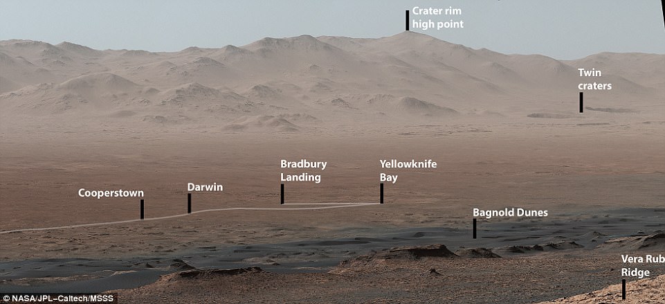
This close-up  it shows the original landing site from 2012, Bradbury Landing, where Curiosity touched down more than 2,000 days ago. It also shows Yellowknife Bay, the place where the rover found an ancient freshwater-lake environment that would have offered all of the basic chemical ingredients for microbial life

Nasa's Jet Propulsion Laboratory in Pasadena, California, released the panorama, which gives an overview of much of the rover's 11 mile (18 km) path along the crater's outer edge. This image shows a scene from the far left of the crater, when viewed from the top of the Vera Rubin Ridge

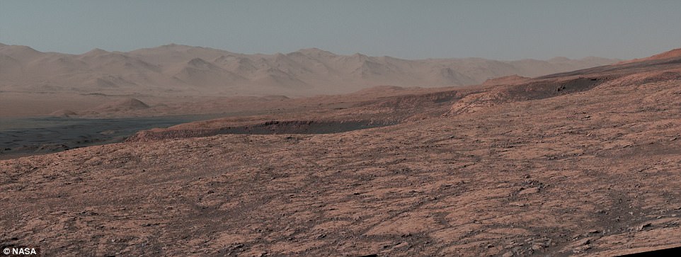
Most of the scene's horizon is the Gale Crater's northern rim, around 1.2 miles (two kilometres) above the rover.  The left-eye camera of the rover's Mastcam took this image, which shows a scene from around two fifths along the ridge

Last week, the Curiosity team on Earth received copious new images from the rover through a record-setting relay by Nasa's Maven orbiter, surpassing a gigabit of data during a single relay session from Mars for the first time in history. This image shows the view of the far right hand side of the crater, from Curiosity's perspective

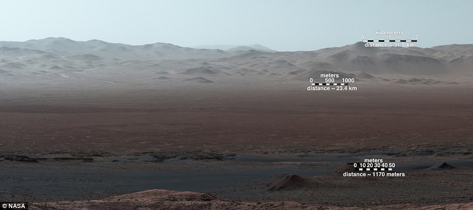
The Mars Curiosity rover was initially launched from Cape Canaveral - an American Air Force station in Florida on November 26, 2011. This image, which shows the view from just over halfway along the ridge, displays metre measurement bars for scale

As well as the lanscape photo which was stitched together by 16 images from the wide-angle lens of the left camera on the rover, the car-sized robot also took closer images of a specific spot for more detail (pictured)

Sixteen images of the landscape were stitched together by Nasa. The space agency also adjusted the white balance on the images to make the photo look like it would do under normal conditions on Earth, giving the scene a distinctive blue hue. In the background, a mountain can be seen that is 50 miles (80 km) away

Source: Tamol.om

اترك ردّاً

لن يتم نشر عنوان بريدك الإلكتروني. الحقول الإلزامية مشار إليها بـ *